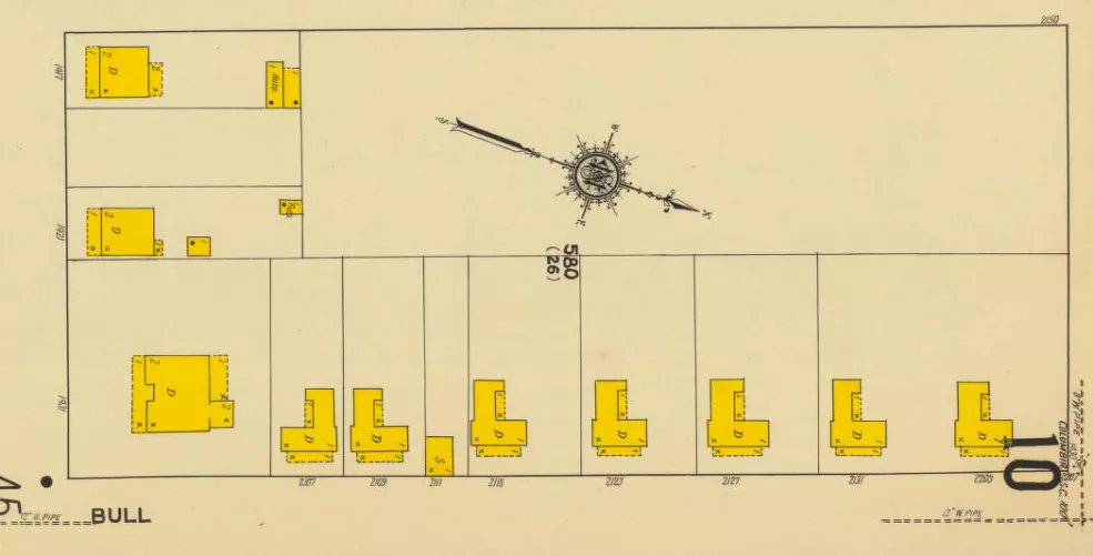
2100 Block of Bull Street
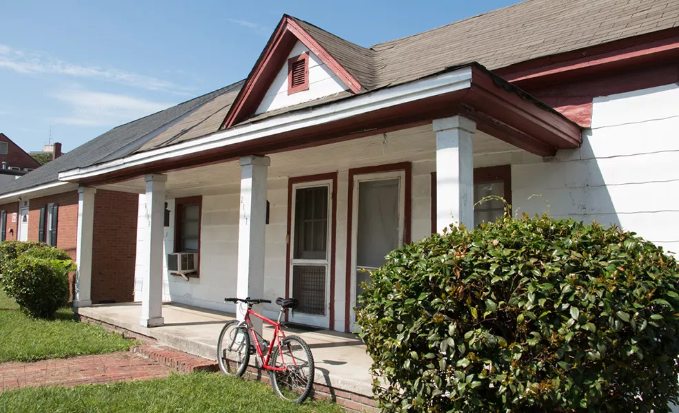
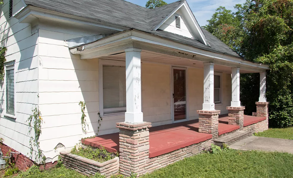
2115, 2117 and 2123 Bull Street
These early cottages, architecturally distinct from other houses within the neighborhood, were likely part of the initial development of the Cottontown suburb. Modest in size and details, these structures stand on property originally owned by William Wallace, who registered the first suburban plot consisting of 16 blocks fronting Bull Street in 1902. City directories from the 1910s indicate that these houses were home to working-class white families, some of whom were grocers and others employees of the Southern Railway and the Seaboard Air Line companies. Currently, the properties are used by the Elmwood Church of God for ministry outreach services.
Origins of Cottontown
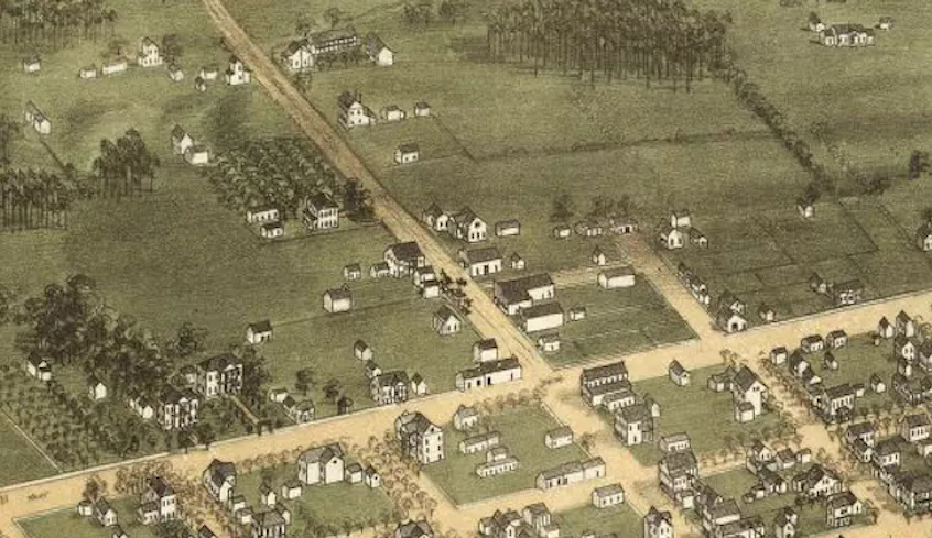
Early graphic references to Cottontown come in the form of maps. Of these resources, C. Drie’s 1872 Birdseye Map of Columbia is one of the most compelling. Drawn during the Reconstruction era, the artist’s rendering offers three-dimensional representations of structures and the land on which they stood.
Of note are the several elongated structures fronting what would become Main Street and a handful of sizeable, two-story residences. Shown, too, are numerous support buildings, or dependencies, and fences. Virtually missing are any trees to the east of Main Street in the present area known as Cottontown, indicating that this area may have been cultivated for growing crops. One of the more curious and fanciful details that Drie chose to include was a number of horses with riders gathered on what would become today’s 2200 block of Main Street.
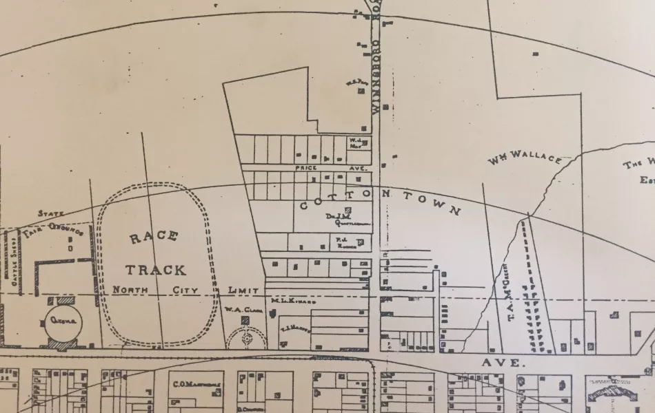
Niernsee and LaMotte’s Map of Columbia, S.C. and Suburbs, published in 1895 (above) indicates that Cottontown was a name assigned to an area spanning both sides of the Winnsboro Road (today’s North Main Street). Ultimately, land to the west of this main thoroughfare would be associated with the suburb of Elmwood, whereas Bellevue, more popularly referred to today as Cottontown, would lay to the east. Columbia’s city limits have moved just north of Elmwood Avenue, formerly referred to as Upper Street. This boundary, depicted by a repeating dash and double dot line, effectively incorporated the majority of the modest development that had been included in the 1872 map. When compared with Drie’s representation, it is apparent that little development had occurred in over two decades, except for construction of a row of what appears to be 29 small structures located on land owned by T.A. McCreery, the proprietor of a dry goods store at 1642-1646 Richardson (Main) Street. While the nature of these buildings most likely was residential, their existence appears to have been short-lived, most likely due to increased development of the new suburb of Bellevue after 1902.
Directions:
Next1427 Elmwood Avenue