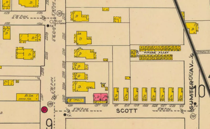
Northwest corner of Sumter and Scott Streets
Site of Titanic Alley
Certain areas of Cottontown have changed so greatly that no physical evidence of their early character remain. Historic maps often offer dramatic representations of such transformation. For instance, in 1919 the block bounded by 2200 North Main Street to the west, Scott (formerly Frost) Street to the south, and Sumter Street to the east featured a densely packed array of 40 residences. Among them stood a significant number of shotgun-style houses and a range of 24 tenements to a street named, ironically, "Titanic Alley".